
Developing Flood Maps
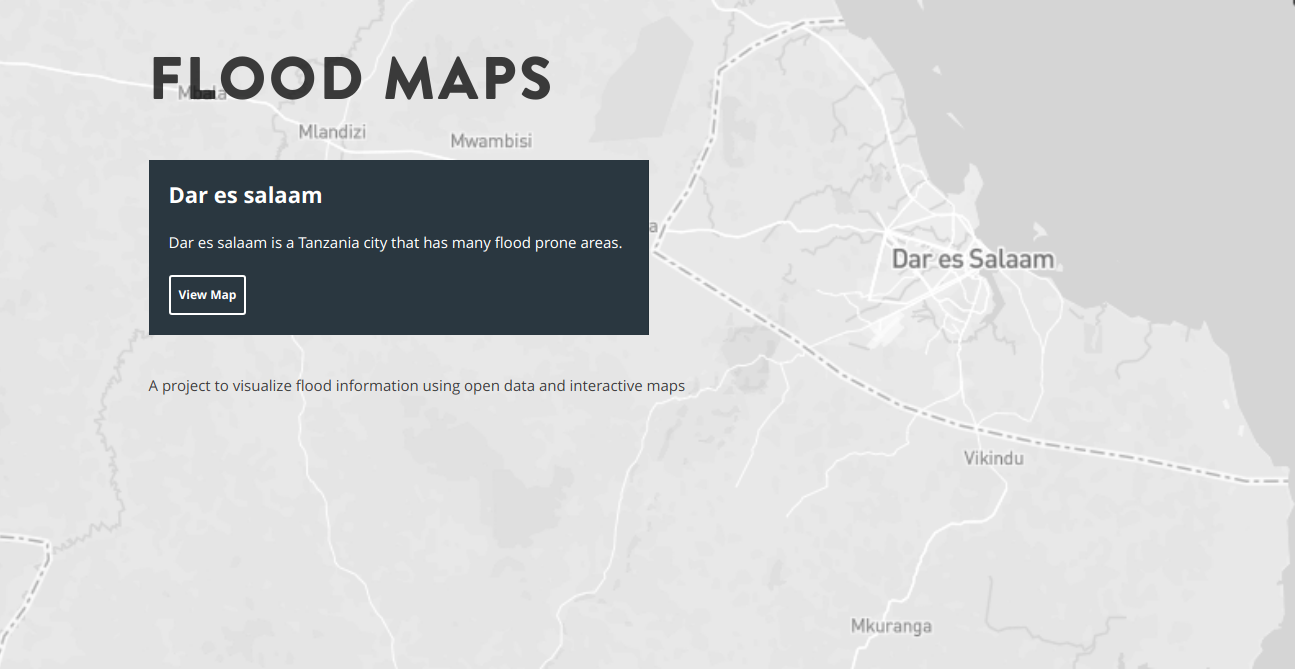
Floods in Dar es salaam
Dar es salaam is one of the fastest growing cities in Africa, it has a 5 million population and 5.6% percent growth rate per year, it is also the most important economic center in Tanzania. This indicates that the city should undertake all social and economical preparations effectively accommodate population growth.
However, for the past years the city has been overwhelmed by the growth rate of the population leading to inadequate public services provision, unequal resources sharing such as water, electricity and a dormant urban infrastructure. The latter being the major cause for the recurring floods in the city.
As the city continues to expand, much of the new development has occurred informally and without adequate planning. This unstructured urban sprawl has placed huge strain on the road network and drainage systems, making mobility increasingly difficult. During the rainy season, poorly planned settlements—often built in flood-prone areas, makes the situation more difficult by blocking natural water channels, further contributing to the severity and frequency of urban flooding.
Floods Map Tool
In relation to the flood problem in Dar es salaam, I made an effort to help the society in reporting of the floods events, believing this will enable measuring floods impact and foster robust response during raining seasons.
An online flood map, Inspired by flood map india, a tool that shows flooded features in realtime as reported by map users, this is crowdsourced based effort to map inundated features in Dar es salaam.
In response to the flooding challenges in Dar es Salaam, I took the initiative to support the community by developing a tool aimed at improving the reporting of flood events. I believe that by enabling timely and accessible flood reporting, it will make it possible to better assess the impact of flooding and support more coordinated and effective responses during the rainy seasons. Collecting such data from those directly affected offers crucial insights into the severity and spread of floods, helping both authorities and communities prepare and respond more efficiently.
To bring this vision to life, I developed an online flood mapping platform, inspired by the flood map india project. The tool allows users to contribute real-time updates about flooded areas using a crowdsourced approach.
Similarly, the Dar es Salaam version of the map empowers residents to report inundated roads, neighborhoods, and key infrastructure in real time. By relying on contributions from the public, the platform builds a dynamic, community-driven picture of flood conditions across the city.
This tool serves as both a public awareness and a practical response aid. It helps identify flood hotspots as they occur, enabling faster decision-making for rerouting traffic, allocating emergency resources, or issuing alerts. Over time, this kind of community mapping can also support long-term urban planning by highlighting areas that require drainage improvements or other interventions.
The flood map is a step toward participatory resilience building. By involving citizens directly in disaster response, it strengthens the relationship between the public, urban planners, and emergency services, paving the way for a more informed and resilient Dar es Salaam.